DroneSense, a Texas-based drone software solution specialist for the public safety sector, has announced new features and integrations to make mission-critical operations smarter, safer, and more efficient. Here are the key highlights…
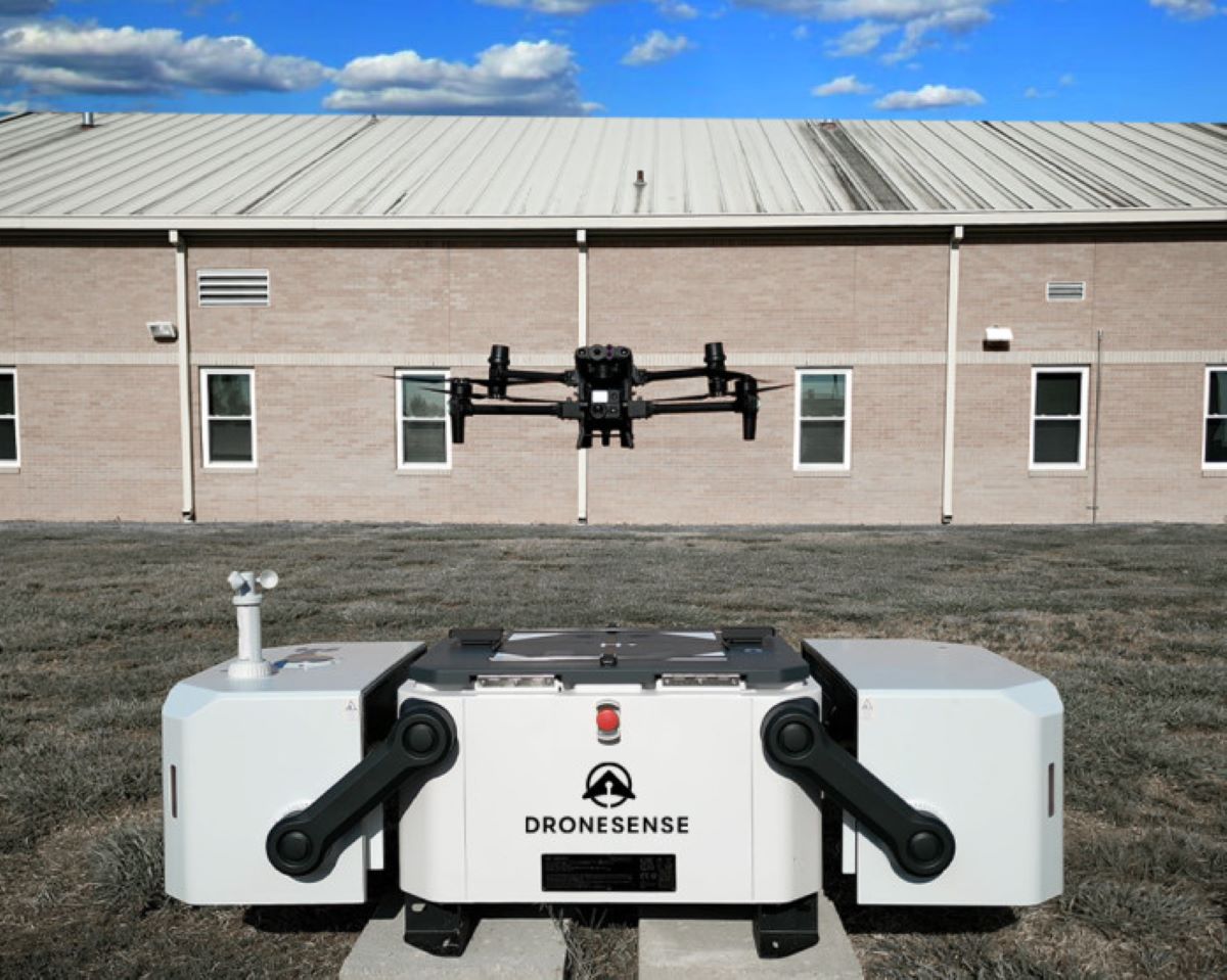
- Dock Integration: DroneSense now offers an advanced integration that facilitates cloud-based operations with the DJI Dock drone-in-a-box system. Public safety agencies can use this innovation to simplify and automate the launching and retrieving of drones.
- Airspace Awareness: With the new Airspace Awareness integration, DroneSense provides agencies with real-time information about the airspace where their drones operate. This includes details on other crewed and uncrewed aircraft and dynamic airspace restrictions, which can prove extremely useful while monitoring a natural disaster, tracking suspects, or conducting search and rescue missions.
- Terrain Following: This feature allows drones to maintain a consistent altitude above the ground, even in areas with varying topography. As such, operators can remain assured that their drones will maintain a safe distance from the ground, obstacles, or changes in elevation. The result is a safer mission, without worry that the drone will crash into an object mid-flight.
- CoPilot: The CoPilot integration allows operators to seamlessly stream video even from drones that are not directly integrated with the DroneSense platform. Imagine a scenario where different agencies use various drone models or have existing drone equipment that they need to utilize effectively. CoPilot bridges these gaps, allowing for easy integration of diverse drone fleets. This compatibility streamlines the process of live-streaming video, ensuring that critical information is readily accessible to teams on the ground.
“As a leader in the public safety drone industry, we are committed to providing agencies with the most advanced tools to help them save lives and protect their communities,” says Chris Eyhorn, cofounder and CEO of DroneSense. “These new integrations and features are a testament to our dedication to our mission. DroneSense truly has everything an agency needs in one platform.”
Read more: Zing’s drone Remote ID broadcast module gains FAA approval
FTC: We use income earning auto affiliate links. More.
You’re reading DroneDJ — experts who break news about DJI and the wider drone ecosystem, day after day. Be sure to check out our homepage for all the latest news, and follow DroneDJ on Twitter, Facebook, and LinkedIn to stay in the loop. Don’t know where to start? Check out our exclusive stories, reviews, how-tos, and subscribe to our YouTube channel.


Comments