The Defense Innovation Unit (DIU), in partnership with the Air Force Research Lab (AFRL) and several tech companies, recently conducted groundbreaking flight operations to demonstrate a new system for managing drone traffic. This three-day event at the New York UAS Test Site evaluated the integration of advanced technologies to ensure drones can operate safely and efficiently in the national airspace.
The initiative tested a system called the Collaborative Low-Altitude UAS Integration Effort (CLUE) Uncrewed Traffic Management (UTM), developed by AFRL. This system is designed to help manage the increasing use of drones, especially those supporting Department of Defense missions. As David Michelson from DIU pointed out, it’s crucial to distinguish trusted drones in our airspace as drone usage grows.
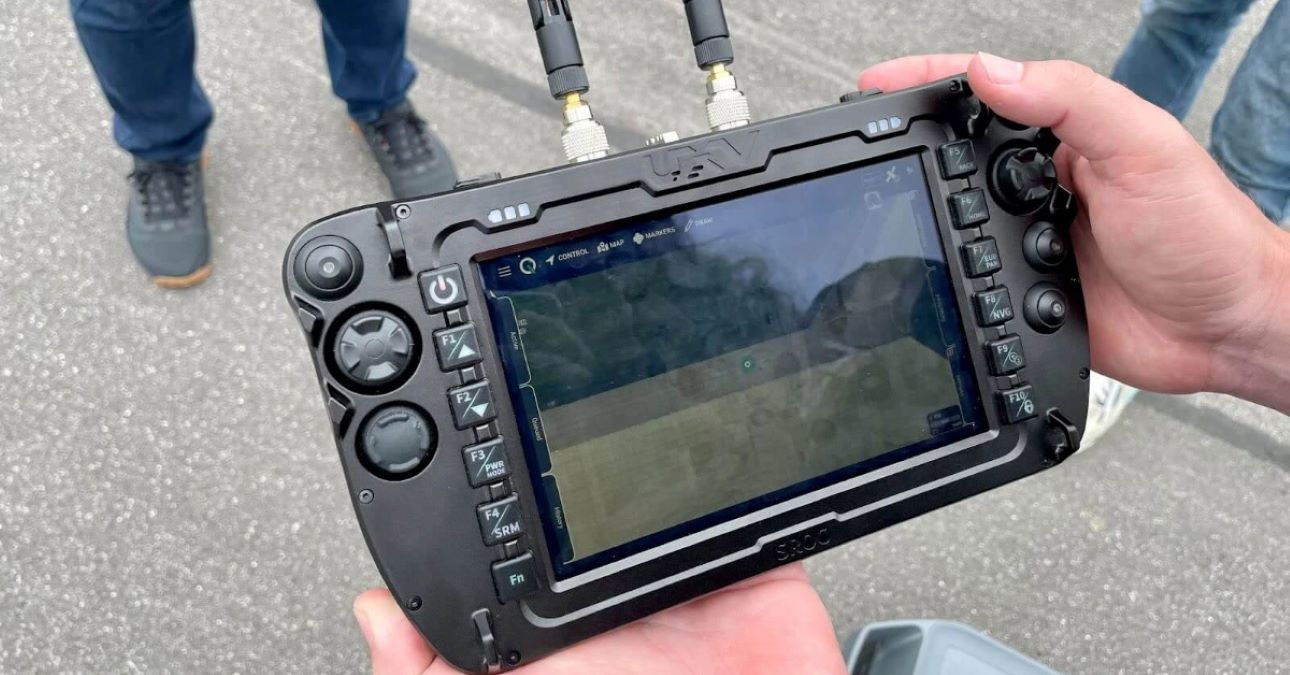
Key participants included AgEagle, Auterion GS, AX Enterprize, Skydio, and Somewear Labs. The demonstration featured AgEagle’s eBee VISION and Skydio’s X2D drones, which supplied telemetry data back to the CLUE UTM system through a Somewear Node multi-network device. These drones were controlled by ground control stations equipped with UXV Technologies’ Soldier Robotic Controller and QGC-Gov software, ensuring seamless and secure operations.
The technology used combines the efficiency of mesh radios with the resilience of satellite connections, providing real-time information to the mission command center. The ground control stations connected to Somewear Nodes allowed data to be transmitted via a mesh network, extending connectivity through relay nodes carried by Freefly Systems Astro UAVs. This setup facilitated data sharing with the CLUE UTM software.
By integrating drone telemetry with other data sources, such as surveillance broadcasts and radar, the CLUE system offers comprehensive situational awareness. This assists in air traffic management, ensuring compliance with Federal Aviation Administration regulations and enhancing the safety of drone operations.
This successful demonstration marks a significant step forward in securely managing drone flights, paving the way for more regular and reliable drone operations worldwide.
Read more: SkyeBrowse releases GPS tool, speed update for drone 3D models
FTC: We use income earning auto affiliate links. More.


Comments