Spanish researchers are turning to drones packing Light Detection and Ranging (LiDAR) sensors in their management of the nation’s forests facing the annual summer scourge of massive wildfires.
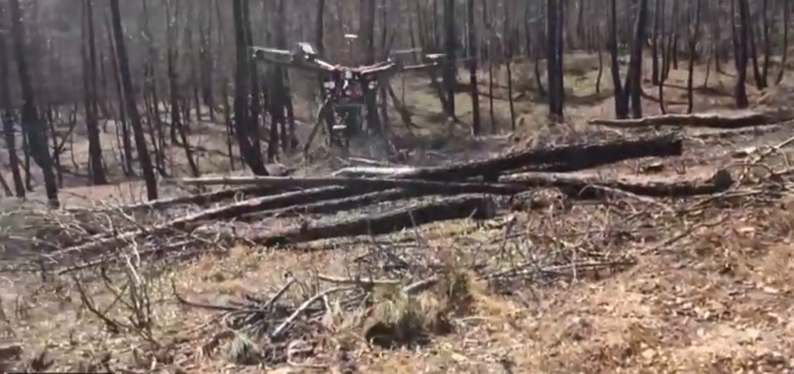
Drone’s LiDAR sensor provides ground-level forest mapping
Experts at Spain’s Toledo University have partnered with European LiDAR specialist Routescene to gather data on not just where recent fires burned with the greatest fury. Those surveys also profile foliage that suffered less damage – or none – which in turn provides forestry authorities with information on preventive measures and vegetation management.
The partners used Routescene’s LiDAR sensor and analytical software to take readings of a 3,217 hectare, 2017 forest fire site in Albacete province. The mapping flights occurred six months later to give recovery growth time to begin.
The missions produced information on where different vegetation had been located, its abundance and condition, and how fast that it had burned compared to other foliage. In doing so, a Routescene report on its study noted, it was important to understand what had gone up fastest, and what hadn’t.
Wildfires don’t burn evenly through forests. What remains of trees and vegetation after a fire is a good indication of its severity. In a forested landscape some areas may be barely scorched. However, in other parts the trees will be severely damaged with branches and leaves fully burnt.
Drones flying far lower than satellites can
Fly-overs allowed the LiDAR sensor to collect tree-top level data, as well as ground-level information captured through gaps in the foliage. That was processed into canopy height and digital terrain models capable of detailing the species and condition of individual trees. By operating drones closer to ground level, the missions came away with far more precise data than satellite shots usually relied on.
They found that unburned and low-severity burned areas were more diverse in tree structures than moderate and high severity burned ones. This data was previously not attainable using satellite imagery. The project demonstrated the potential to distinguish post-fire plant structures in detail using UAV LiDAR data. When crossed with satellite-based fire severity metrics, the high resolution results will allow researchers to estimate the impact of fire on single trees not just whole forested areas.
That means lessons learned from fires that have already raged can be extended to analysis and management of pristine forests to decrease risks of those burning. Advanced mapping necessary in that, meanwhile, should provide valuable vegetation profiles to responders battling fires – data indicating where the most intense and rapidly spreading zones will be.
FTC: We use income earning auto affiliate links. More.


Comments