Military-grade drone company Teal Drones says it has partnered with defense tech specialist Reveal Technology on mapping software that automatically combines imagery from multiple drones to produce high-fidelity 3D maps.
This partnership matters because military tactical teams’ ability to quickly produce accurate maps of areas targeted for military operations can mean the difference between mission success or failure. As part of this collab, Reveal’s “Farsight” mapping software was recently demonstrated to US Army Special Operations Command in North Carolina.
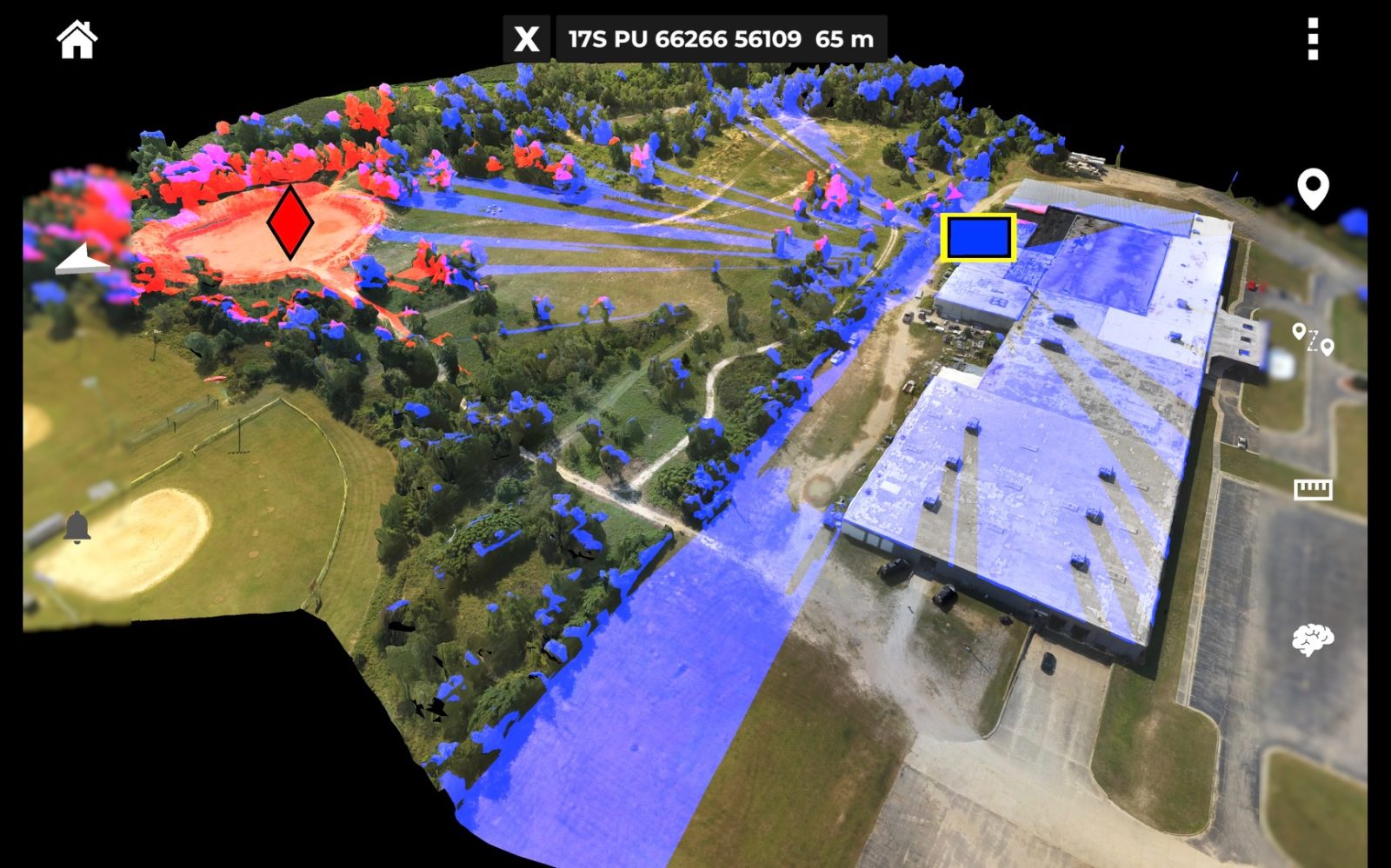
A division of Red Cat Holdings, Teal Drones launched the 4-Ship multi-drone system in June to enable a single operator to simultaneously control up to four of its Golden Eagle drones. While 4-Ship allows for instant and ongoing 360-degree surveillance of a target, Farsight gives military teams near-real-time access to detailed 3D maps of a target area that can be overlaid with:
- Line-of-sight analysis, which allows a team to choose a route at the target area that is least visible to the enemy
- Terrain analysis and graphing
- An AI-generated “best route” through a target area, based on line-of-sight data, elevation mapping, and terrain analysis
- A vertical measurement tool, for determining the height of buildings and structures that may be part of an operation
- A helicopter landing zone survey, to quickly identify the best and safest spot to land
These combined features, Teal Drones says, can provide a team with an advanced awareness of the situation, leading to more successful missions.
Read: Autel EVO II V3 drones, Smart Controller hit the FCC
As Red Cat CEO Jeff Thompson puts it:
A primary role of Teal Drones – which is one of only a handful of drone companies approved to provide equipment to the US military – is to provide a superior airframe upon which others build apps that allow the military to better meet their objectives, including warfighter safety mitigation. This integration of Reveal’s Farsight software with Teal’s 4-Ship product is one of the most important apps that has been developed for the Golden Eagle so far.
Read: SkyeBrowse Android app for DJI, Autel drones is now available
FTC: We use income earning auto affiliate links. More.


Comments