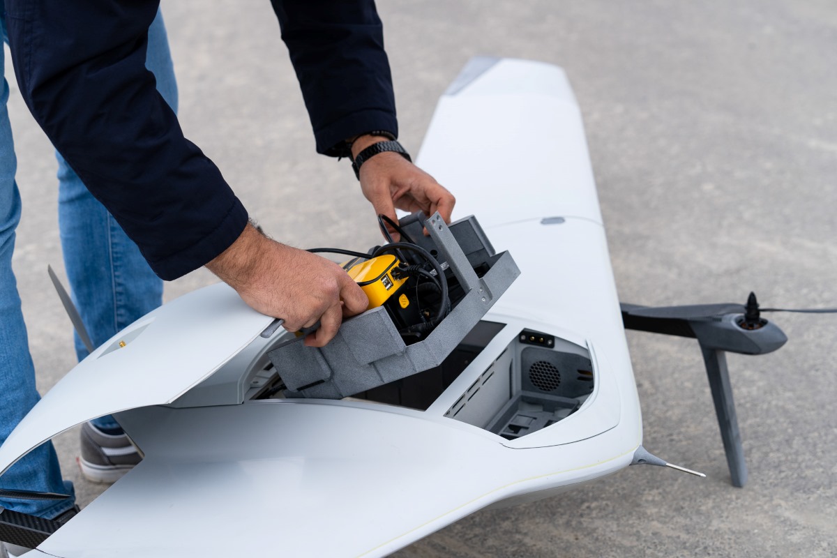
Dutch drone maker DeltaQuad says its latest Evo aircraft with a flight time of up to 2.5 hours is now integrated with a combined Yellowscan LiDAR and RGB system. As such, the fixed-wing vertical take-off and landing (VTOL) drone can offer colorized LiDAR mapping for up to 500 hectares in a single flight.
The integration of an RGB sensor enables the colorization of georeferenced LiDAR points. This improves both the usability of the drone data and the identification of intricate details.
Read: New Insta360 thumb-sized camera arrives next week — is it GO 3?
Most quadcopters that can carry both LiDAR & RGB systems deliver flight times of up to 30 minutes, which is good to cover around 100 ha. At the same time, there are fixed-wing VTOLs available in the market today that can carry LiDAR systems covering up to 400 ha. But since they don’t have an RGB sensor integrated, they have to conduct the same flight twice to capture both kinds of data.
DeltaQuad is striving to overcome exactly these limitations with its long-range Evo drone. Further, the universal payload bay of the aircraft has a “Click & Go” mechanism with automated payload recognition, so operators can build their own multipurpose sensor ecosystem.
Read: DJI releases patch to clean up buggy mess of Terra v3.7.0
According to the company, the Evo drone can carry payloads of up to 3 kg, with the opportunity to combine two different sensors during one flight (RGB, Multispectral, Thermal, ISR, or any customized sensor). Users can also swap one of these sensors with an auxiliary battery to reach up to 4.5 hours of flight time.
The highlight of the Yellowscan system is that can capture up to 200 data points per square meter, with drone data processing being managed through YellowScan CloudStation software to ensure quick turnarounds for large mapping projects.
As Tristan Allouis, cofounder and CEO of YellowScan, states:
Working with DeltaQuad is a thrilling experience as we collaborate to create inventive solutions for demanding applications. Our shared dedication ensures the delivery of highly efficient and reliable solutions for our valued customers.
Read: Microdrones unveils EasyOne, new survey-grade LiDAR drone
FTC: We use income earning auto affiliate links. More.


Comments