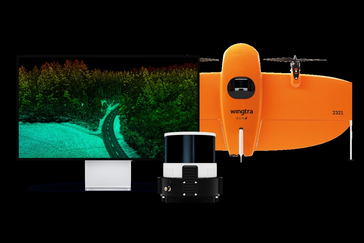
Switzerland-based VTOL drone manufacturer Wingtra has released a new LiDAR payload for its GEN II commercial mapping drone. The solution is being hailed as a significant advancement in lightweight drone sensors since it pairs precision with instant data alignment, unmatched ease of use (no calibration required), and exceptional efficiency.
The new LiDAR solution from Wingtra features a Hesai scanner, Inertial Labs IMU, and NovAtel GNSS. It requires no calibration and initializes in just one minute. The advanced technology dramatically reduces the need for time-consuming post-processing strip alignment, delivering precise terrain information immediately from each efficient flight.
Moreover, the intuitive Wingtra LiDAR app and automated data capture are easy enough to use by even those who are new to LIDAR data capture, saving at least an hour per survey compared to other systems in its class. Julian Mackern, a product manager at Wingtra, tells DroneDJ the company is already seeing early customers comment on how surprisingly easy it is to set up, fly, and generate a high-quality point cloud.
Also read: GeoCue unveils three new TrueView LiDAR systems for drones
Here’s Carlos Femmer, director of data acquisition at global firm HDR:
We’re seeing [United States Geological Survey topographical] quality level zero results on hard surfaces, which are quality results. We were able to test the horizontal and vertical strip alignment quality. We looked at both vegetated areas and non-vegetated areas, and it’s very clean, it aligns well. There’s minimal noise as compared to other LiDAR sensors in this price range and it delivers exceptional overall precision.
Wingtra LiDAR offers 3 cm (1.2 in) vertical accuracy, verified by early users as top of the range from a 60 m (200 ft) flight height. Point density is also top-notch with the WingtraOne GEN II’s design and automated flight pattern ensuring consistency across different pilots.
Femmer says, “Wingtra’s automated LIDAR capture is, in my opinion, better than other systems in this price range. I can send three different pilots to the same location and get the same quality result processing on the back end.”
Read more: 5 DJI products on sale that make great Valentine’s Day gifts
FTC: We use income earning auto affiliate links. More.


Comments