By detecting and identifying vegetation irregularities at an early stage, drone-based remote sensing can minimize losses to growers everywhere. But do the current methods of aerial remote sensing qualify to be called “precision” agriculture? Not really, according to this manufacturer of multispectral sensors.
Ira Dvir, an Israel-based pioneer in the field of video compression and imaging technologies, is convinced there’s a fundamental flaw with the multispectral imaging camera sensors on agricultural drones today.
As he puts it, “When you’re not likely to rely on a physician who says he can tell you what’s wrong with you from, let’s say, a three-meter distance, how can you rely on an agricultural survey based on multispectral imagery which was acquired by a sensor of 1.2 or 1.3 MP per band from an altitude of 100 meters?”
So, after developing video CoDecs (the world’s first commercial AVC SW CoDec, licensed to Cyberlink in July 2004) and other innovative imaging products for 15 years, Ira and his partner, Dr. Nitzan Rabinowitz, decided they would do their bit to save crops at an early stage.
“The trigger was the realization that in the US alone, losses from this problem are estimated at over $40 billion per year,” Ira explains. “And examining the existing solutions, we found that people are either stuck with satellite imagery or solutions that are based on guesstimation rather than real, first-order analysis of the problem.”
And thus was born Agrowing, a company that makes award-winning patented drone sensors that promise to overcome some of the major issues of multispectral agriculture imagery acquisition. The startup also offers a cloud-based software service that uses artificial intelligence to automatically detect and identify pests, diseases, nutrient deficiencies, etc., while analyzing the soil quality and providing yield predictions.

Agrowing was established with a vision to take imprecise aerial remote sensing from a high altitude to leaf level AI-based analysis. Our sensors leverage internationally-patented technology, while the design is based on high-quality optics (F6 20-25mm focal depth) multiple lenses, multiple bandpass filters, single sensor, single mechanical shutter, and adjacent lenses. We solve most of the issues of multispectral imagery acquisition, which are: synchronization, parallax, dynamic range, chroma aberration, and distortion.
Also read: XAG unveils 2022 autonomous agriculture drone lineup
Ira says his innovations can beat market-leading products, such as the new Altum-PT by MicaSense, in a heartbeat. A bold claim, but he backs it up by saying:
The Altum is based on a multi-camera design, and its resolution and dynamic range is rather poor. You get about 3MP per band, and it is based on an electronic shutter which is good for video but poor for still images. In addition, the distance between the different cameras does not allow close range good alignment of the bands. The number of bands is also far from the 10 or 14 we offer at a lower cost with 4x the resolution. Our 10 band 12MP per band sensor cost (MSRP), based on the Sony A7RIVA camera body is $10,000, which is two-thirds the price of the new Altum.
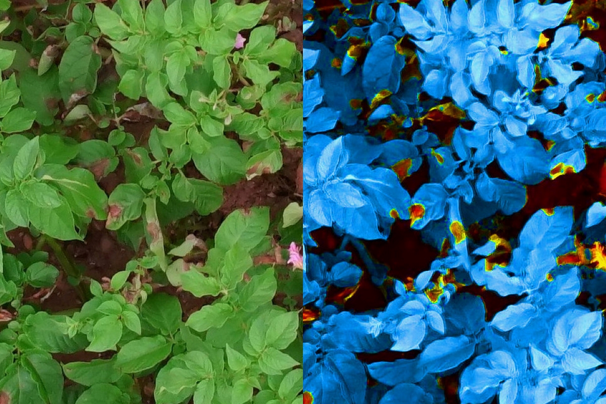
Ira also considers Normalized Difference Vegetation Index (NDVI) – the most well-known and used index map produced from multispectral imagery – as only an initial step required for real leaf-level analysis.
“NDVI means late detection due to resolution,” he quips. “It also means an inaccurate classification of the second order. NDVI cannot be considered as ‘precision agriculture’ as it is imprecise by definition. Still, highly-detailed NDVI of 1.5cm per pixel can enable the detection of outlying spots in the field, where close range multispectral analysis of imagery, which is acquired at sub-1mm per pixel, enables precise classification and identification.”
But, in the end, farm owners don’t really care about the technology at play, do they? They just need simple answers that would grow their profits.
This is exactly why “weeds” is not a good enough answer, Ira says. “The specific weed identification is a must for the farmer since they need to select the right pesticide for the job. Is it Alternaria or Blight in my potato field? Definite classification is a must, otherwise, it means: ‘Go check in the field’, when, in many cases, they don’t have the manpower to do it.”
The company’s AI algorithms come into the picture here. These algorithms, Ira explains, are based on distinctive signatures of the diseases, pests, and nutrient deficiencies, a farmer may be looking to identify.
The technology is proven and Agrowing is already working with more than a dozen universities as well as drone manufacturers and service providers. But this number, Ira stresses, is going to skyrocket soon.
“Looking at the work that companies like SeeTree are doing with our sensors or the results our platforms are enabling for researches like the Brazil-based Vetorgeo, there’s little doubt that aerial precision agriculture will turn into an essential service in the coming years all over the world,” he sums up, adding that Agrowing is currently looking for Series A funding to expand its sales, design a wider angle 24MP/36MP per band lens, and develop a patented multispectral mobile camera kit for smartphones.
Read more: DJI releases two new agricultural drones in China: Agras T40 and T20P
FTC: We use income earning auto affiliate links. More.


Comments