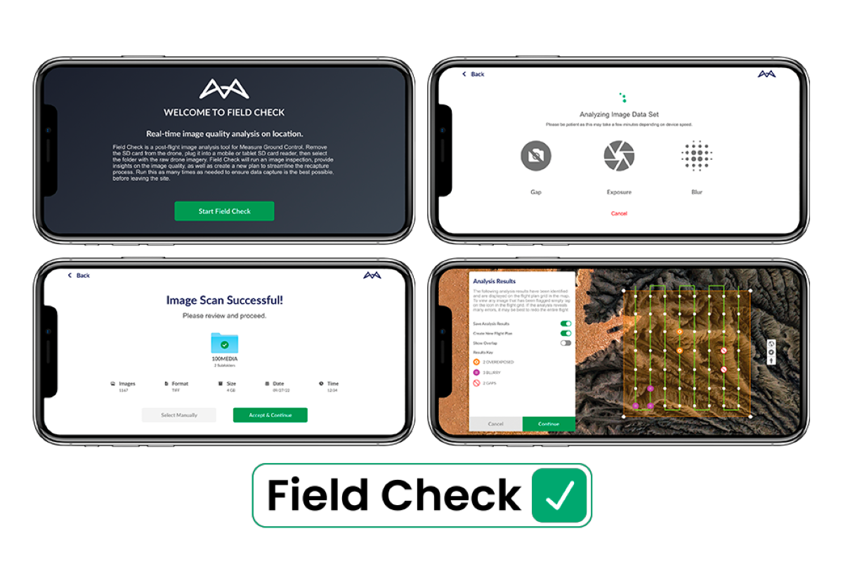
Drone program management software Measure Ground Control has added a new feature called Field Check to its mobile app. Field Check lets drone operators review and check the quality of mapping imagery while still on-site.
Measure is a part of Kansas-based AgEagle Aerial Systems which also owns the eBee line of fixed-wing drones and MicaSense sensors. The Measure Ground Control software – whose capabilities include mission and equipment management, flight control, data processing and analysis, secure data storage and sharing, online collaboration, and reporting – is available as a web tool and mobile app for both iOS and Android devices.
The new Field Check feature is exciting because it can flag poor quality, missing or blurry imagery, as well as images with an insufficient overlap or exposure, which can be marked for re-capture. The app then automatically generates a new flight plan to recapture the essential images.
Read: Mavic 3 Pro: Leak indicates new DJI drone with three cameras
Capturing target imagery right the first time is essential to keep down the cost associated with a project. If the operator knows that the data is complete and ready for processing into high-resolution outputs before leaving a site, it can reduce the time wasted and the cost involved in traveling to and from the site to recapture data. Aerial Imaging Technology, a California-based aerial data collection and analytics company, has also recently released a free drone image overlap estimator tool.
AgEagle chairman and CEO Barrett Mooney says that Field Check will transform the way their customers work, adding:
Field Check provides our clients with a competitive edge in their drone operations and across the industries they serve by avoiding project repeats and downtime due to data processing errors or poor image quality.
It’s worth pointing out that AgEagle has also announced new subscription pricing tiers for Measure Ground Control software, tailored to users ranging from individuals and small drone businesses to enterprises. A new Basic subscription plan has been added, while the Pro and Teams pricing has been updated, and annual plans at reduced rates have been introduced.
Read: Chance to win over $500K by landing drone at Victory Day parade in Moscow
FTC: We use income earning auto affiliate links. More.


Comments