
drone surveys

See All Stories

New UgCS 6.0 flight planning software solves a major headache for drone surveyors

SPH engineering UgCS 6.0 drone survey update large area splitting

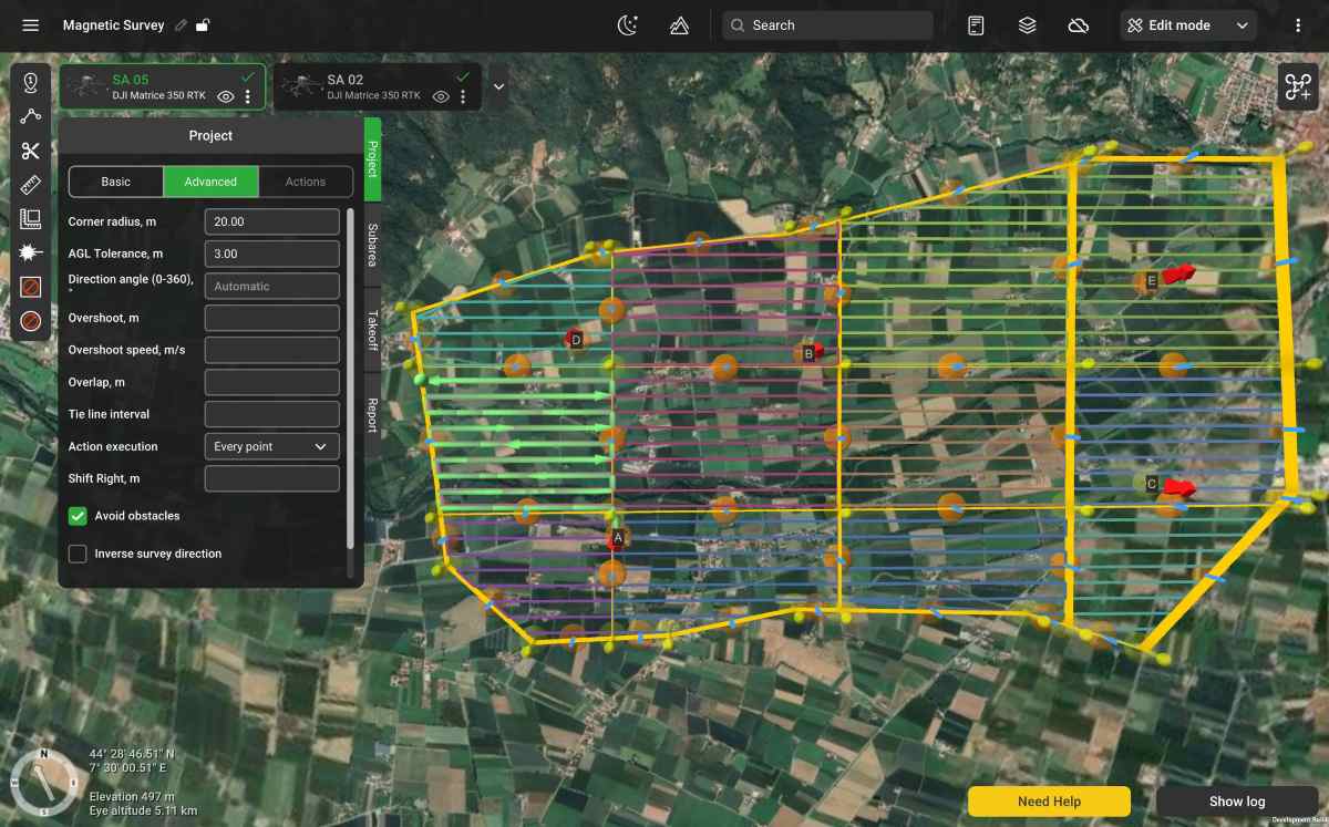
For drone survey teams working across sprawling mines, oil pipelines, and remote geological sites, one frustrating problem has lingered for years: breaking huge survey areas into manageable flight sections without creating alignment issues that can ruin data quality. Now, SPH Engineering says it has solved that challenge with the launch of UgCS 6.0, a major update to its popular enterprise drone flight planning platform.

Expand Expanding Close

Let my gimbal go: NC court case argues drone mapping, surveying is free speech

drone surveying

The effects of drone technology have been sufficiently disruptive – or perhaps “threatening” is a better term – to legacy land surveying officials that a North Carolina aerial imaging and mapping service provider is now having to defend attacks on his activity with arguments it’s a form of free speech protected by the First Amendment.

Expand Expanding Close