Swiss mapping, surveying, and modeling tech company TOPODRONE has introduced its AQUAMAPPER solution that adds underwater LiDAR and bathymetry capacities to the company’s range of drone-transported data collection equipment.
Montreaux-based TOPODRONE developed its AQUAMAPPER device to provide detailed bathymetric data for clients working on marine projects, or those whose surveying or construction activities involve both ground-level and underwater terrain. When paired with the company’s LiDAR ULTRA platform, the AQUAMAPPER rounds out a complete set of photogrammetry, LiDAR, and bathymetry surveying capabilities.
Once mounted on a drone, TOPDRONE says AQUAMAPPER will provide effective and accurate feeds of various kinds of data at flight speeds of up to 14 km/h – rivaling traditional boat-based methods.
The company says the post-processed kinematic-ready solution is designed for use on DJI Matrice 300 RTK craft for surveys including – but are not limited to – open sea bathymetries of up to 100m depth, quantity and calculation of sediments, and periodic maintenance of storage pools.
TOPODRONE provided AQUAMAPPER tech to a European Union-backed highway construction project in Romania that required surveys and digital twin creation of ground-level terrain and areas at the bottom of various bodies of water.
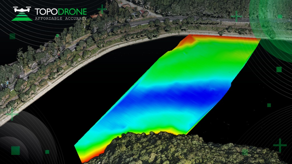
To prepare the project, which involved the creation of seven tunnels, 24 bridges and 18 viaducts, TOPODRONE’s Romania affiliate flew AQUAMAPPER and LiDAR ULTRA tech aboard DJI Matrice 300 drones.
The latter product performed bathymetry surveys of six different river crossings, while the later was used to capture laser scanning data from altitudes of between 100 and 120 meters above rugged forest corridors 32 kilometers long and 400 meters wide.
“The great advantage of the bathymetric equipment from TOPODRONE is it captures riverbeds with centimeter-levels of accuracy, with high speed in fully automatic mode, and without using any boat,” said Andrei Sueran, who worked on the project using the AQUAMAPPER device for the Romanian affiliate, GRAPHEIN TOPO. “It allows us to work in hard to access and shallow water areas, and the same drone carrier can be used for LiDAR and bathymetry surveys. The combination of (global navigation satellite) and inertial measurement systems helps to get accurate results after data post processing, providing a new standard of accuracy, efficiency, and flexibility.”
FTC: We use income earning auto affiliate links. More.

Comments