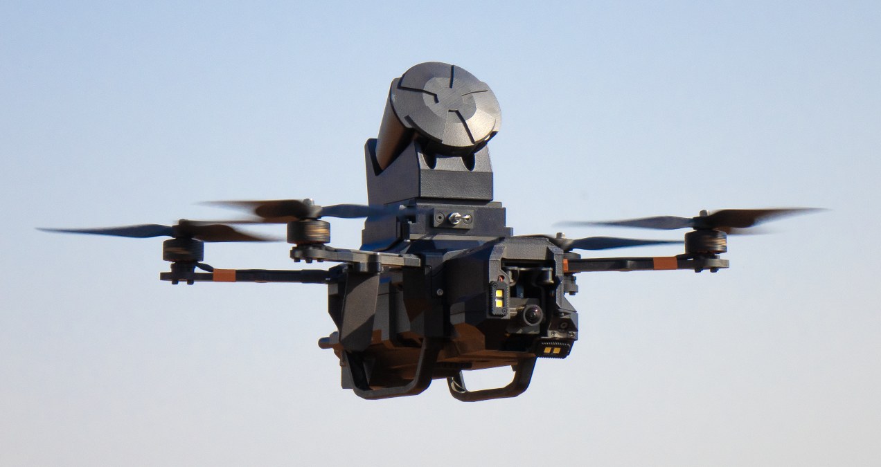
XTEND is doubling down on one of the biggest challenges in modern warfare: how to stop hostile drones, without making things worse in the process. The AI-driven robotics company, backed by Eric Trump, has announced a new partnership with ParaZero Technologies as part of its broader $1.5 billion public-market merger. Together, the companies are rolling out a fully autonomous drone interception system that can detect, chase, and capture enemy drones mid-air using a physical net. Yes, a net.
Expand Expanding CloseAI drones are now catching aerial threats like flying cops